


Video: Inside ATFP Gala 2013

Photo Gallery: ATFP Gala 2013


Robert Mackey
The New York Times (Blog)
May 7, 2009 - 12:00am
http://thelede.blogs.nytimes.com/2009/05/07/the-west-bank-archipelago/
TAGS:
The New York Times (Blog)
May 7, 2009 - 12:00am
http://thelede.blogs.nytimes.com/2009/05/07/the-west-bank-archipelago/
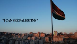
This week, leading Israeli, Palestinian and American officials have agreed that the creation of a Palestinian state on territory in the West Bank and Gaza is essential to peace in the Middle East. But spend any time looking at a map of the West Bank as it is today, or with any of the many different proposals for how that map might be redrawn to accommodate the aspirations of both Israelis and Palestinians, and it becomes clear why any sensible mapmaker might choose to steer well clear of the challenge of drawing up that state.
But first, let’s see where the agreement lies. On Tuesday in Washington, Vice President Joe Biden reiterated that the Obama administration’s vision for peace in the Middle East includes the creation of a Palestinian state. In a speech to members of the American Israel Public Affairs Committee, Mr. Biden said that Palestinians leaders “must combat terror and incitement against Israel” and Israeli leaders need to accept that “Israel has to work toward a two-state solution.” After the aside, “You’re not going to like my saying this,” Mr. Biden emphasized that, to make space for a Palestinian state, Israel has to “not build more settlements,” in the areas of the West Bank it currently controls.
While Israel’s new prime minister, Benjamin Netanyahu, has not explicitly endorsed the creation of a Palestinian state, a report in the Jerusalem Post pointed out that Mr. Biden’s audience agrees with him, “Participants at the American Israel Public Affairs Committee Policy Conference will this week be urging their elected representatives to press President Barack Obama for precisely that.”
The Post added that the group intends to make its support for a two-state solution very clear:
The pro-Israel advocacy group’s annual conference culminates each year with a mass lobbying effort, in which the thousands of participants from across the United States spread out across Capitol Hill for meetings with their respective members of Congress and encourage them to endorse policies and positions that AIPAC believes will advance the American-Israeli interest.
In this year’s lobbying effort, to take place on Tuesday, the AIPAC thousands will be asking their congressmen to sign on to a letter addressed to Obama that explicitly posits the need for a “viable Palestinian state.”
In an interview with The New York Times published on Tuesday, the leader of Hamas, Khaled Meshal, made it clear that his definition of “viable” and Aipac’s are not quite the same. Mr. Meshal said that a Palestinian state should be created on the territory in the West Bank and Gaza that Israel conquered in 1967, which would mean removing hundreds of thousands of Israeli settlers from the West Bank.
Underlining how far that is from Israel’s position, the news agency J.T.A. reported the same day that Israel’s president, Shimon Peres, told Mr. Biden that building on Israeli settlements in the West Bank had to be allowed to continue, since “Israel cannot instruct settlers in existing settlements not to have children or get married.”
So, since Israel has no intention of withdrawing completely from the West Bank, what kind of map might incorporate part of the territory into Israel and still make the remaining part a truly “viable” state?
To get a better idea of where the mapmakers are starting from, take a look at a fanciful map of the West Bank called “L’archipel de Palestine orientale” (”The Archipelago of Eastern Palestine”), drawn by Julien Bousac for the French publication Le Monde Diplomatique, and republished recently on the blog Strange Maps. Mr. Bousac’s imaginary map illustrates how fragmented the areas of the West Bank currently under the control of the Palestinian Authority are by portraying them as islands, divided by areas under Israeli control, which are represented by the sea.
Julien Bousac An imaginary map of the West Bank, showing areas under the control of the Palestinian Authority as an archipelago.
In a post on this imaginary map, the French blogger Gilles Paris shows an excerpt from the real map of the various zones of control in the West Bank produced by the United Nations that Mr. Bousac used as the basis for his drawing. On Thursday, the same U.N. body that produced that map, the Office for the Coordination of Humanitarian Affairs, released a report on the “fragmentation” of Bethlehem caused by Israel’s security barrier and settlements. As The Guardian’s Rory McCarthy reports, Israel’s new foreign minister, Avigdor Lieberman, “lives in Nokdim, one of the Jewish settlements in the Bethlehem area.”
In an interview, Mr. Bousac told the blog Strange Maps that his map “is not about ‘drowning’ or ‘flooding’ the Israeli population, nor dividing territories along ethnic lines,” but is simply “an illustration of the West Bank’s ongoing fragmentation based on the (originally temporary) A/B/C zoning which came out of the Oslo process.”
As Arthur Goldschmidt explained in his “Concise History of the Middle East,” the zones of control on the West Bank today were created by negotiators in Oslo in 1995:
In September 1995 Israel and the Palestinians signed another agreement (often called Oslo II), containing an intricate plan for Israel’s gradual withdrawal from the West Bank (but not any part of Jerusalem). Oslo II set up three West Bank zones. Zone A comprised eight West Bank cities, including Jericho, which was already Arab-controlled. Palestinian authorities would become responsible for internal security and public order, except for parts of Hebron containing Jewish settlers. Zone B consisted of other West Bank towns and villages, where Palestinian police would eventually maintain order but Israel retained overriding authority for security. Zone C included Jewish settlements, unpopulated areas, and lands Israel viewed as strategic. Israel retained full security authority for Zone C, pending “final status” talks.
As Strange Maps explains, “the dotted lines symbolising shipping links, the palm trees signifying protected beach land, and the purple symbols representing various aspects of seaside pleasure” are “totally fanciful but the small blue ships, next to those parts of the map labeled “Zone sous surveillance” (”Zone under surveillance”) have “some bearing on reality, as the locations of the warships match those of permanent Israeli checkpoints.”
What Mr. Bousac’s imaginary map does quite neatly is illustrate that while there are countries in the world made up of pieces of land as divided as those parts of the West Bank currently under Palestinian control, there are none that are not real archipelagos, surrounded by water, rather than by parts of another state.
Since some degree of fragmentation is a feature of many of the maps proposed by Israeli governments in recent years for the shape of a Palestinian state, it seems important to ask what chance a country with this landlocked archipelago shape really has of becoming a viable nation-state.
This leaves aside the more obvious problem that the biggest island in a Palestinian archipelago is the Gaza Strip, which is completely cut off from the West Bank. In a fascinating essay in the Abu Dhabi newspaper The National, the Indian writer Pankaj Mishra looked at parallel in the recent histories of Israel and India, and that prompts the thought that we have seen an attempt to create one country out of two isolated territories in the past — in the form of Pakistan, which originally included the mass of territory that eventually broke away to become the separate country of Bangladesh. That history, unfortunately, does little to support the idea that a similarly divided Palestinian state will have an easy time developing into one country.
»
TAGS:
Recent Daily News Articles
| What is to be done between now and 2SS? | September 17, 2017 |
| Israeli Apartheid | March 14, 2013 |
| The settlers will rise in power in Israel's new government | March 14, 2013 |
| Israel forces launch arrest raids across West Bank | March 14, 2013 |
| This Court Case Was My Only Hope | March 14, 2013 |
| Netanyahu Prepares to Accept New Coalition | March 14, 2013 |
| Obama’s Middle East trip: Lessons from Bill Clinton | March 14, 2013 |
| Obama may scrap visit to Ramallah | March 14, 2013 |
| Settlers steal IDF tent erected to prevent Palestinian encampment | March 14, 2013 |
| Israel Arab Education Plan to Boost Growth | March 14, 2013 |
Recent News

.@ZiadAsali: By focusing on transition phase, good governance must top agenda to build Palestinian infrastructure
https://t.co/fL2mlkG4Y5
8 years 40 weeks ago
|
In @TheNatlInterest ATFP Pres. @ZiadAsali asks if the two-state solution still exists?
https://t.co/fL2mlkG4Y5
8 years 40 weeks ago
|
RT @Ibishblog: This is sober and correct https://t.co/217oW6j5eC
8 years 41 weeks ago
|
American Task Force on Palestine - 1634 Eye St. NW, Suite 725, Washington DC 20006 - Telephone: 202-262-0017